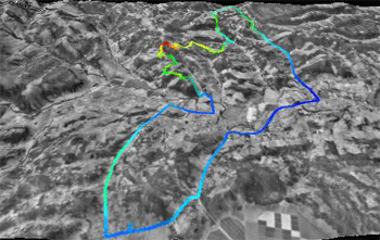
Because
of our moving, it had been 5 weeks without a ride. My route plans changed
when I meet up with Rex. We left the road so he could show me a scenic
way home. A way with a view.. and fences.. and hills.. and poison oak!
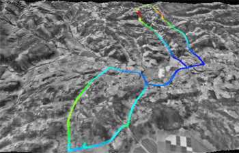
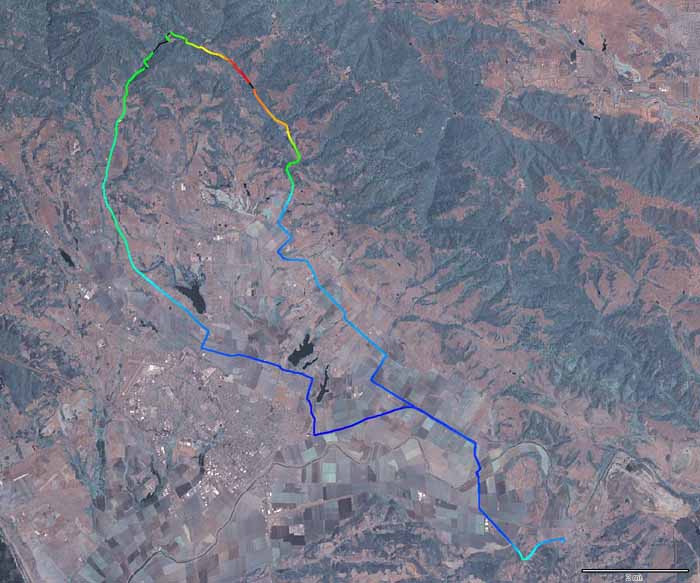
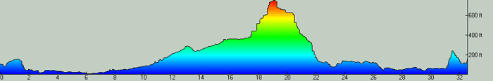
This
was my planned first road ride. I got to ride it a week later. Compare
the elevation difference on the chart label. Note- there is NO level
ground here.
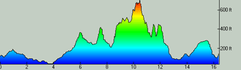
- looking South -
Distance:
16.4 miles
Time: 2:07 hrs
Climbed:
1944 ft
% grade: 4.6% avg
(steepest: 20.4%)
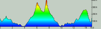
Distance:
15.0
Time: 1:13 hrs
Climbed:
1028 ft
% grade: 2.6% avg
(steepest: 11.6%)
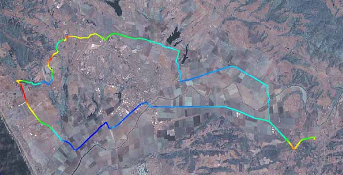
-
looking North - In search of a level road ride...
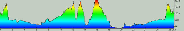
Distance:
28.75miles
Time: 2:02 hrs
Climbed: 1121 ft
% grade: 1.5% avg
(steepest: 6.4%)
This
is as level as it gets..
Hazel
Dell / Browns Valley Rd.
Distance:
32.5miles
Time: 2:07 hrs
Climbed:
1489 ft
% grade: 1.8% avg
(steepest: 10.2%)
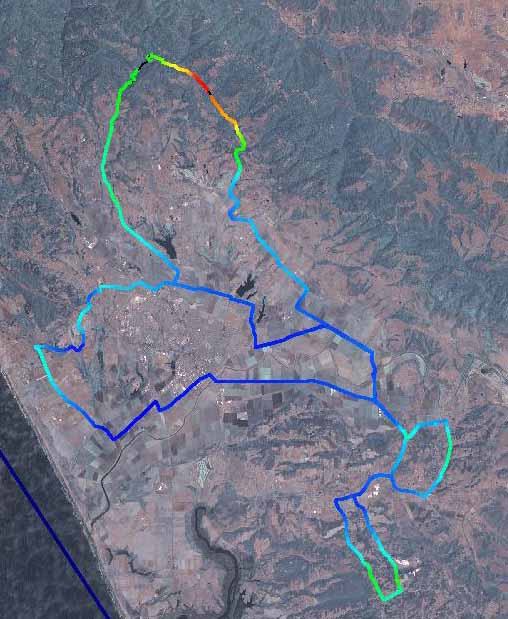
Arial
map showing three ride:
- Hazel Dell top loop
- Buena Vista middle
- Prundale hills bottom 2